
ICELAND
12-Days Itinerary - Around the Ring Road
Part 3: Day 9 to Day 12
Hello fellow traveller!
If you are reading this, probably you have seen some awesome photos of Iceland and planning your trip to go there. Indeed, Iceland is an awesome place and the most scenic place we’ve travelled to thus far because every corner just leave you awestruck with its beauty.
This will be Part 3 of the 3 posts that will bring you around the famous Ring Road which covers the whole of Iceland (Note: The Golden Circle will be covered in these itineraries as well). We’ve created a custom google map and an excel file of all the places covered here. From there, you will able to see the duration it takes to travel from one location to the other. Of course, you can tweak the itineraries to your own preferences. Please request it in the “Contact” section and we will send it over to you.
Make sure to read this post: Iceland (General Info) to get background of what to expect in Iceland.
Day 9: In between 2 continental plates and Kerio
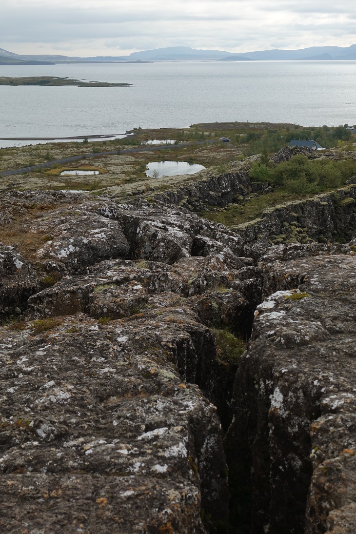
Silfra Fissure
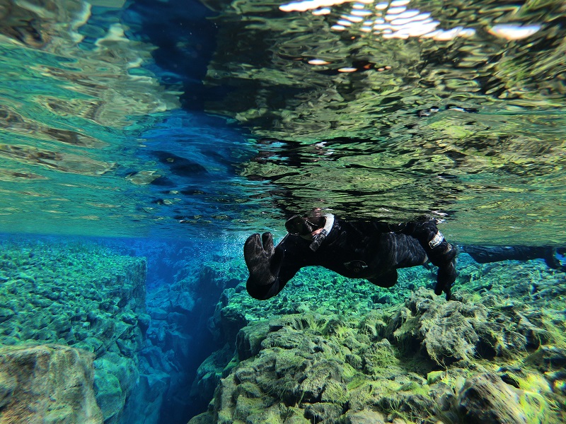
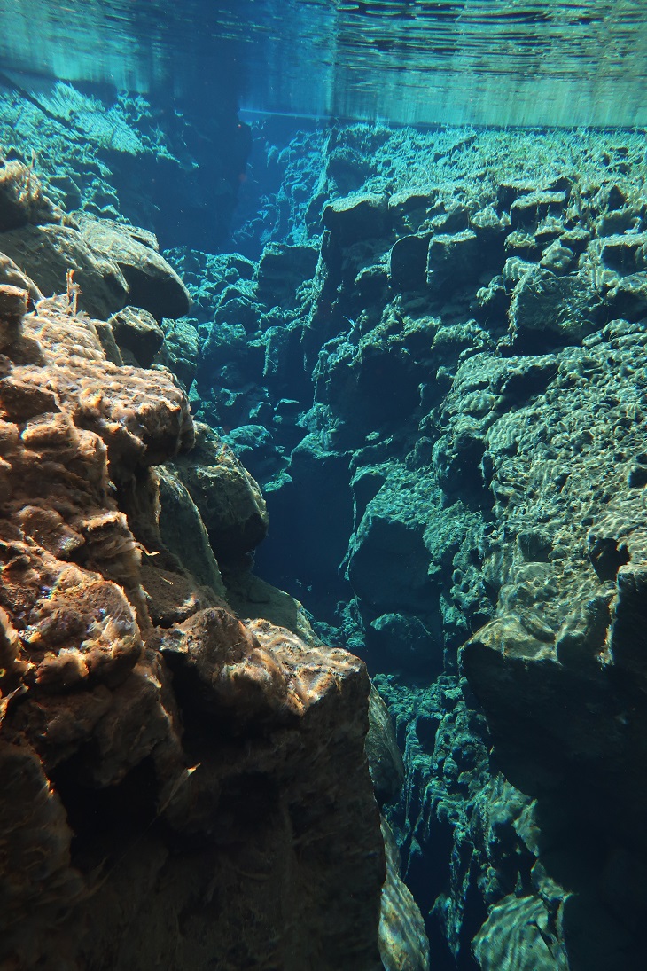
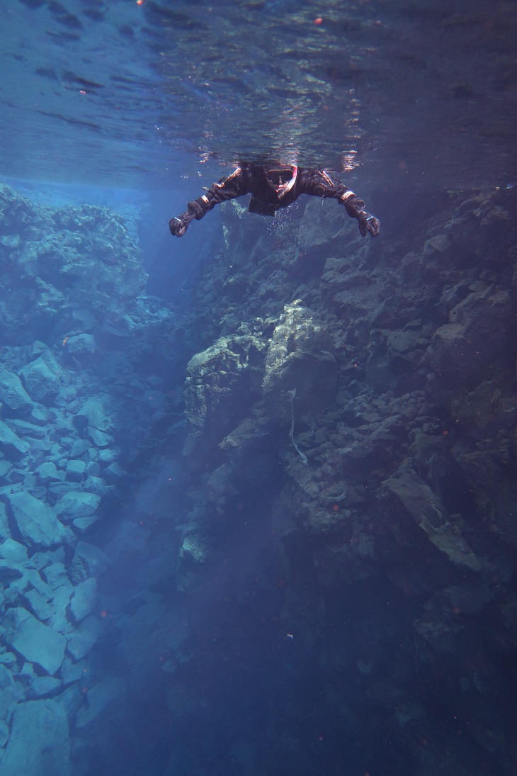
Silfra is a fissure filled with fresh spring water within Þingvellir National Park. The North American and Eurasian plates, which run all the way through Iceland, separate at about 2 centimetres per year, and as they do, they tear open fissures in the land between them.
Water travelling underground through the porous lava fields in the area, originating from Langjökull glacier about 60 kilometres north. It can take the water up to a century to reach Silfra and this long filtration process results in the water being both extremely clear and drinkable.
The clarity of the water is what draws most visitors. The visibility can extend to over 100 metres, allowing you to see the canyon walls and bottom like you are floating over a great cathedral.
The last colour that water absorbs is blue, which means that when you look forward in Silfra, it is as if you are looking into an ethereal, vivid, azure world. The clarity also means that sun-rays refract through the surface of the water, creating rainbows on Silfra’s bed when the weather allows.
Thingvellir
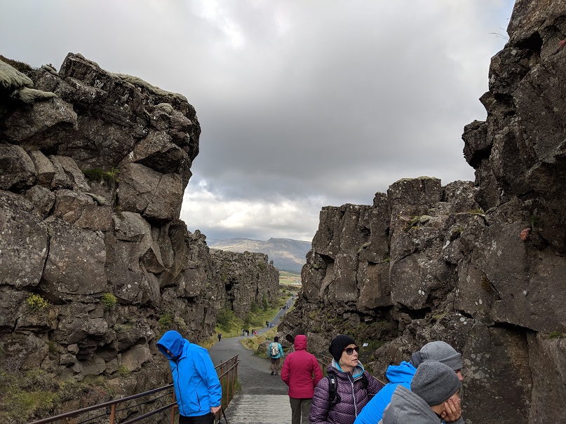
Thingvellir (Þingvellir) is the place where the history of the nation truly began and where almost all its major historical turns were made.
Iceland’s settlement by the Norse started with the arrival of Ingólfur Arnarson in 874, and for the next 56 years, the era was called ‘The Settlement Period’. Driven away from a newly united Norway under King Harald Fairhair, many communities from many different clans started to spring up all around the island’s shores.
The Þingvellir area was chosen for this reason and for its accessibility to the most populous regions of the north, south and west. The longest journey a goði (chieftain) had to travel was 17 days, from the easternmost part of the country where mountains and glacial rivers proved bothersome obstacles.
In 930 AD, over thirty ruling chiefs met for the first time to discuss law on the island and to create a commonwealth.
It was here that the nation abandoned Asatru, the Old Norse pagan belief system, in lieu of Christianity in 1000 AD, due to the threat of Norwegian invasion.
You can walk alongside both of these plates. One of the park’s most pleasant walks takes you between the edge of the North-American plate and an old part of the wall that collapsed away; this is called the Almannagjá gorge. This path impresses the geological processes going on here upon you very clearly, and ends with a charming waterfall called Öxaráfoss.
Kerio
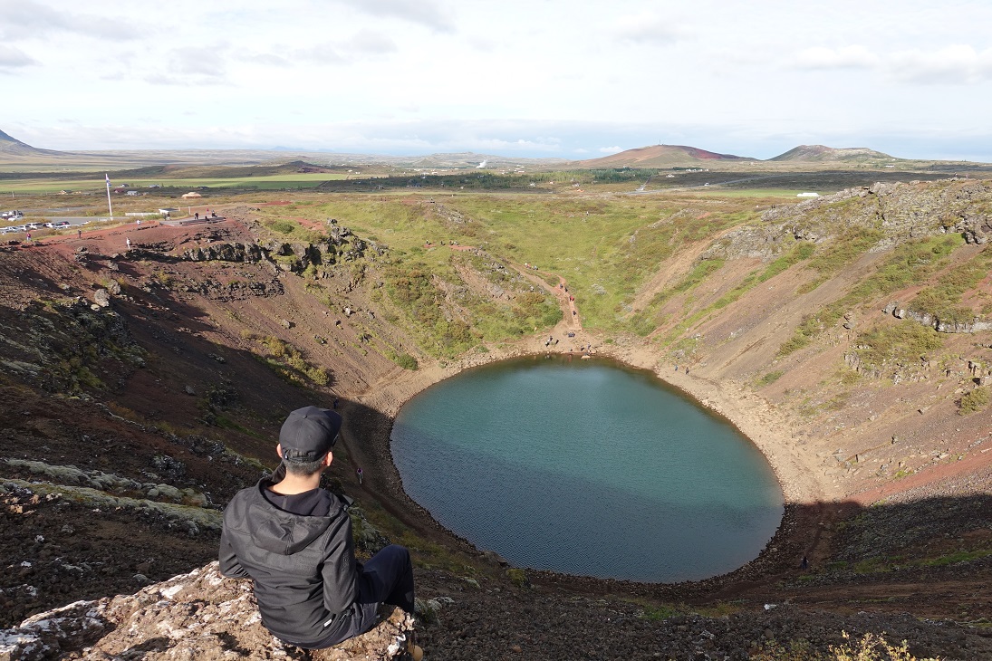
Kerið is a volcanic crater lake located in the Grímsnes area. It’s caldera is visually still intact.
Please be aware that there is a small entrance fee, of 400 ISK (about two Euros, or three US dollars). This is only to help the landowners preserve and protect the crater; after all, it is on privately owned land.
Airbnb 5
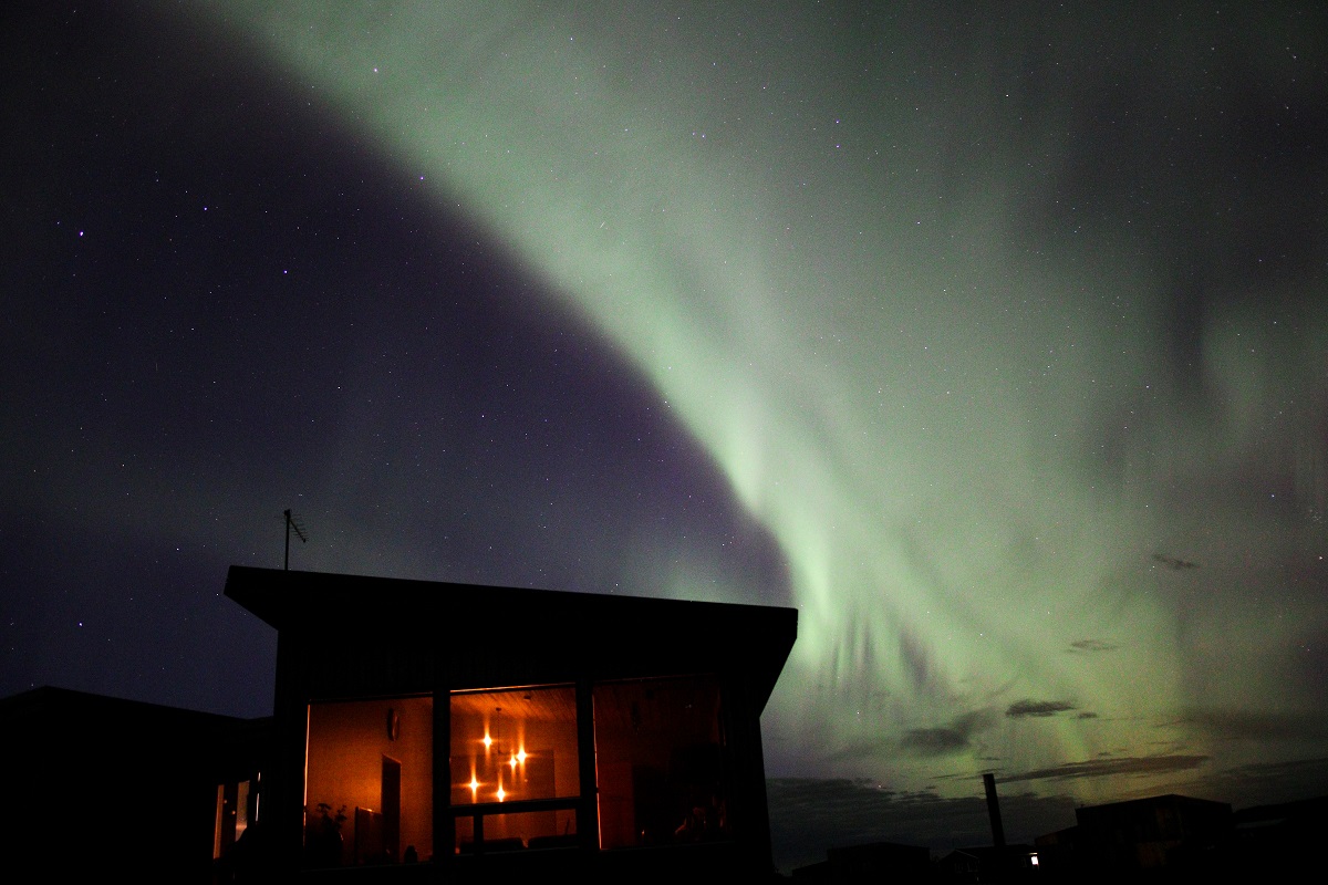
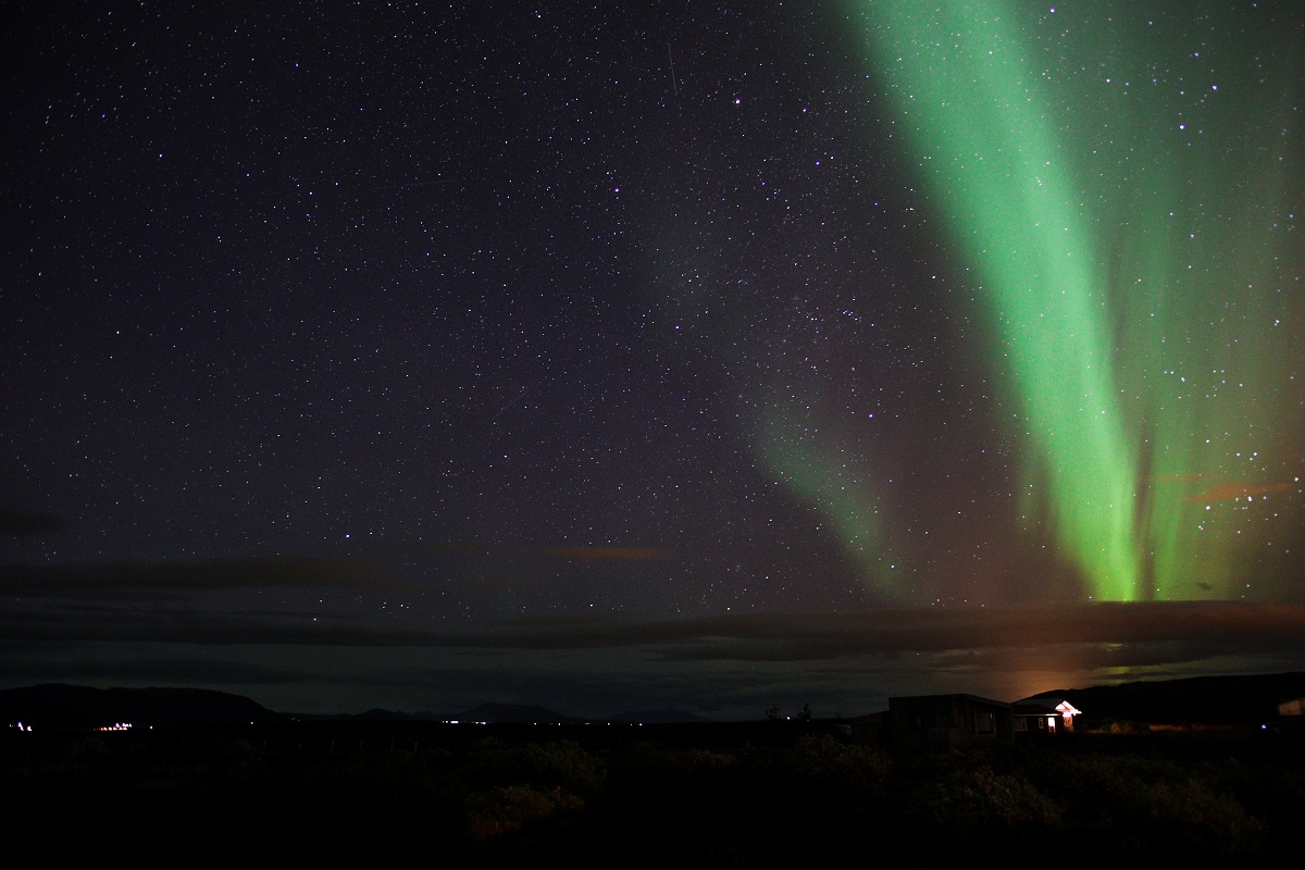
A handful of isolated stylist summer houses in a secluded area, this airbnb is where we got to see the Northern Lights again.
This area is totally free from light pollution and the houses are isolated on its own. You can experience the Northern Lights right on your porch on a clear night sky.
Day 10: Geysirs and waterfalls
Strokkur and Geysir
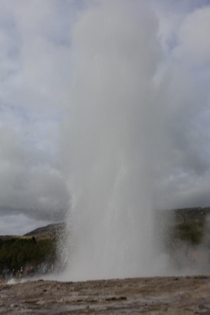
There are 2 famous geysers here, Strokkur which erupt once every 6–10 minutes and Geysir which erupts between a few years. Geysir is much larger, so when it erupts the water will shoot up to 4 times higher than Strokkur.
Active geysers like Strokkur are rare around the world, due to the fact that many conditions must be met for them to form. They are thus only found in certain parts of highly geothermal areas.
The first condition that is necessary is an intense heat source; magma must be close enough to the surface of the earth for the rocks to be hot enough to boil water. Considering that Iceland is located on top of the rift valley between the North American and Eurasian tectonic plates, this condition is met throughout most of the county.
Secondly, you will need a source of flowing underground water. In the case of Strokkur, this comes from the second largest glacier in the country, Langjökull. Meltwater from the glacier sinks into the surrounding porous lava rock, and travels underground in all directions.
Finally, you need a complex plumbing system that allows a geyser to erupt, rather than just steam from the ground like a fumarole. Above the intense heat source, there must be space for the flowing water to gather like a reservoir. From this basin, there must be a vent to the surface. This vent must be lined with silica so that the boiling, rising water cannot escape before the eruption.
Gullfoss
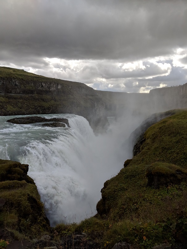
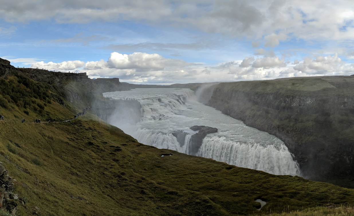
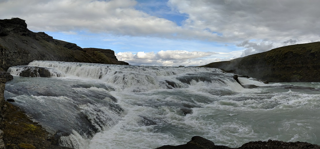
Gullfoss is the waterfall in the upper part of the Hvita river. The water cascades down in two stages, one 11 m (36 ft) high, and the other 21 m (69 ft), into the 2,5 km (1.6 mi) long crevasse below. This crevasse was created at the end of the Ice Age by catastrophic flood waves and is lengthened by 25 cm (9.8 in) a year by the constant erosion from the water.
An interesting story which shows why Iceland’s nature is free from human altercation. In the early days of the last century, Gullfoss was at the centre of much controversy regarding foreign investors and their desire to profit off Iceland’s nature. In the year 1907, an English businessman, Howell, sought to utilise the waterfall’s energy and harboured ambitions to use its energy to fuel a hydroelectric plant.
At the time, Gullfoss was owned by a farmer named Tómas Tómasson. Tómas declined Howell’s offer to purchase the land, stating famously “I will not sell my friend!” He would, however, go on to lease Howell the land without the knowledge of a loophole that would allow him to proceed with his plans.
It was Tómas’ daughter, Sigríður Tómasdóttir, who would lead the charge to stop Howell’s ambitions. Having grown up on her father’s sheep farm where she helped pave the first road to Gullfoss, she sought to get the contract nullified, hurriedly saving her own money to hire a lawyer.
The ensuing legal battle was an uphill struggle; the case continued for years, forcing Sigríður to travel many times by foot to Reykjavík, a distance of over 100 kilometres (62 miles). Circumstances became so difficult that Sigríður threatened to throw herself into the waterfall if any construction began.
Her tenacity, however, resulted in success. In 1929, Howell’s withdrew from the lease, unable to keep up with the costs and difficulties of his plan. The waterfall fell back into the hands of the Icelandic people.
Today, Sigríður is recognised for her perseverance in protecting Gullfoss and is often hailed as Iceland’s first environmentalist. As such, she is one of the most famous figures in Iceland’s history. Her contribution is forever marked in stone; a plaque detailing her plight sits at the top of Gullfoss.
Interestingly, the lawyer who assisted Sigríður, Sveinn Björnsson, went on to go down in history too; he became the first president of Iceland in 1944.
Haifoss
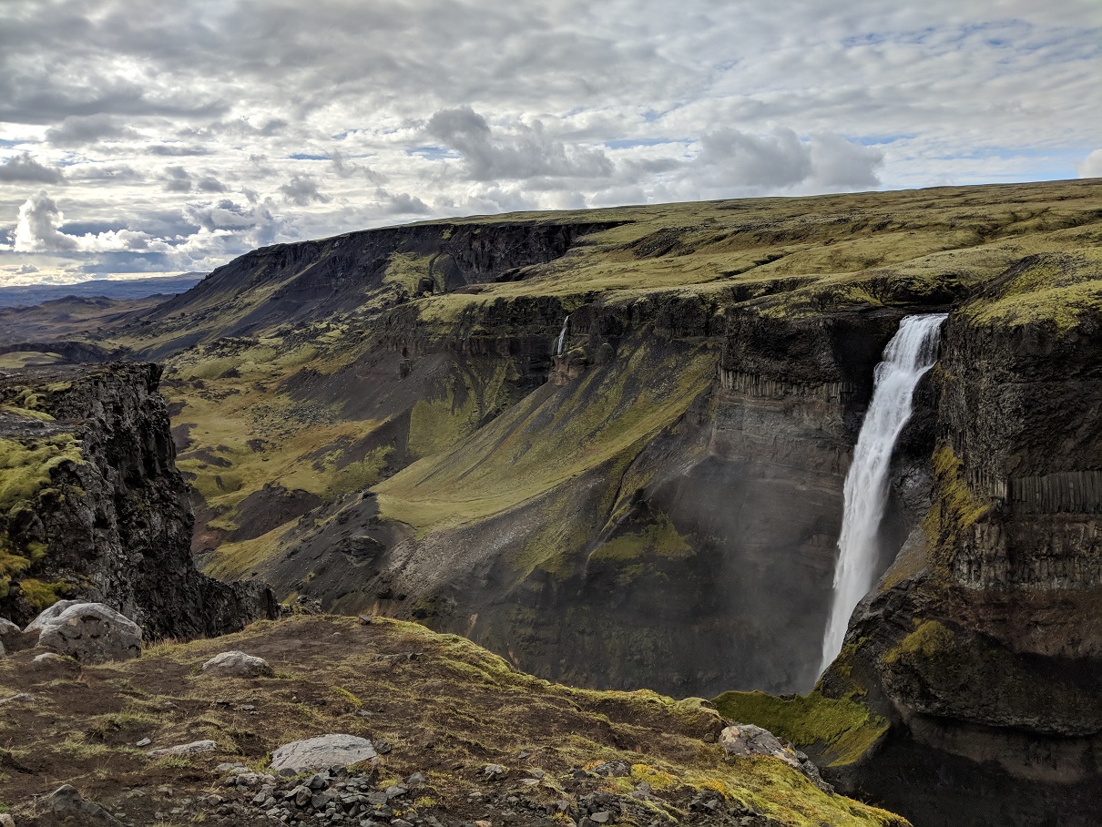
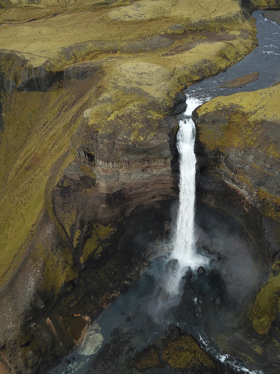
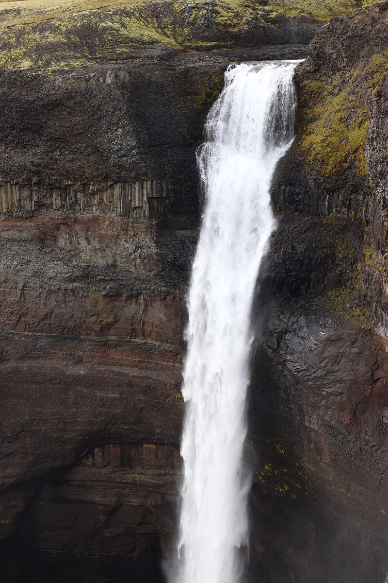
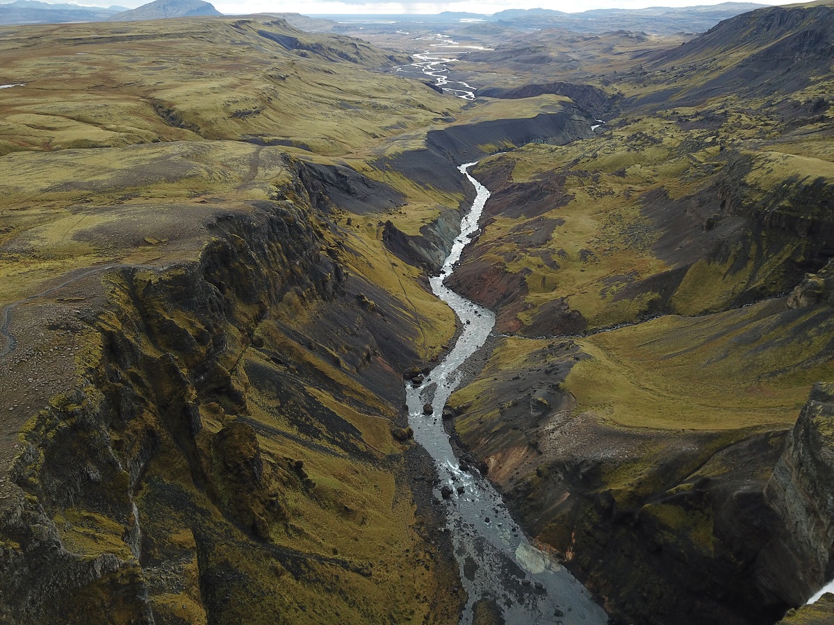
Háifoss, which is 122 meters high is situated in Fossá river, which is a spring water tributary of the glacial river Þjórsá, Iceland’s longest river.
Another beautiful waterfall, Granni (Neighbour), is almost next to Háifoss, and this pair of waterfalls make for one of the most beautiful sights we’ve have seen in Iceland. Standing above these two waterfalls is like looking at a painting or a panoramic photo. It is absolutely breathtaking.
The road to the waterfalls is a bumpy one and we would recommend not going there unless you have a 4×4 car.
Day 11: Reykjavík
Hallgrimskirkja church
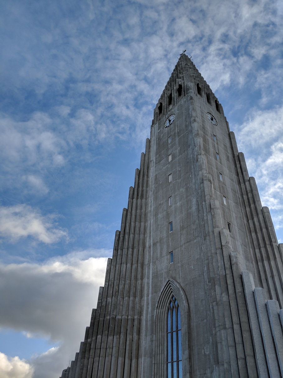
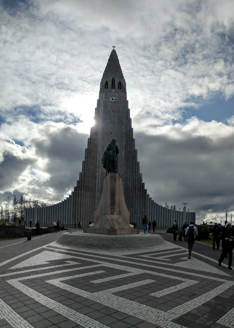
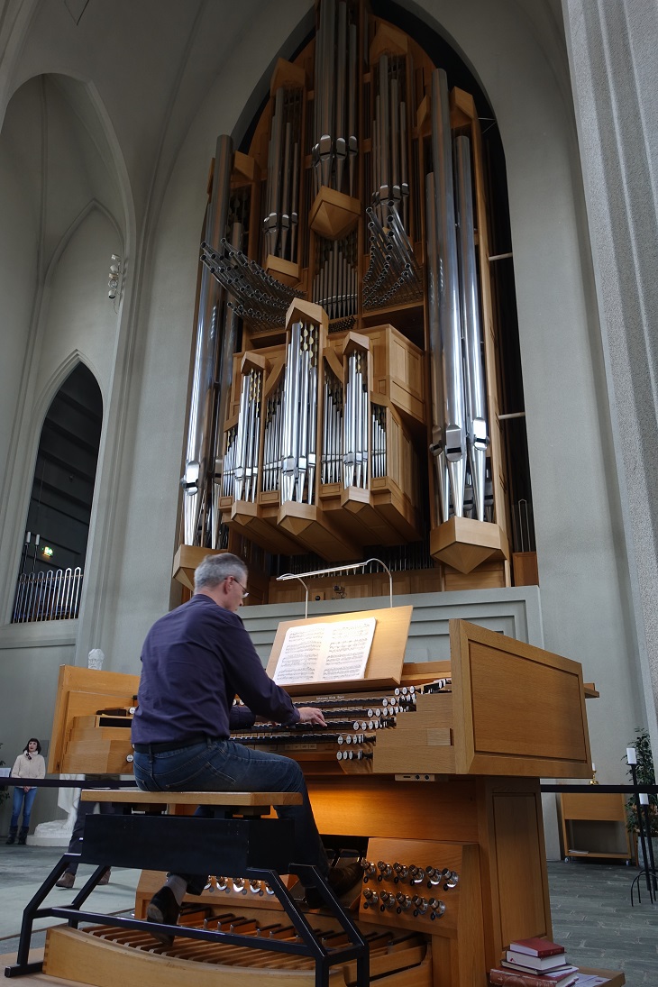
Hallgrímskirkja church is Reykjavík’s main landmark and its tower can be seen from almost everywhere in the city.
It was designed by the late Guðjón Samúelsson in 1937, who wants to create an Icelandic national architectural style that’s inspired by its incredible natural and geographical features.
And in Iceland, the most common geological feature is the ubiquitous basalt columns as the glorious creation of the volcanoes and glaciers. The span of the jagged columns on both sides created a memorable wide facade, inspired by the world-renowned black sand beach Reynisfjara on the South Coast, and Svartifoss.
Bankastraeti
Bankastræti is a street in Reykjavík’s city centre which runs from the west ends of Laugavegur and Skólavörðustígur to the intersection at Lækjartorg. This is the main street in Reykjavík.
Hot dog (Baejarins Beztu Pylsur)

You can get hot dogs in every petrol station and they are delicious. Baejarins Beztu Pylsur, located in Reykjavík offers more varieties of hot dogs.
Why is hot dog in Iceland so good? While most hot dogs in the world are made out of pork or beef, the hot dogs here are made from lamb meat.
The sauces and sides are also ingredients that makes it special. You can have a hot dog with homemade crispy onions and sweet mustard, along with raw onion, ketchup and remoulade. The ketchup is actually made from apples instead of glucose.
Day 12: Fly Out
Iceland is nothing short of amazing. Now it’s time to pack up and share the awesome memories with family and friends back at home. Till we meet again 🙂